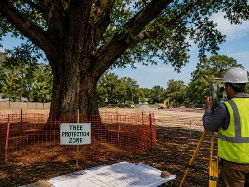
A protected tree can change a project as soon as it is found on the site. Local rules protect certain tree species and sizes. Reviewers enforce these rules, and a design that ignores a protected tree may not receive a permit.
Some project teams think that placing one dot on a plan is enough. It is not. Designing around protected trees requires survey work that treats every tree as a measured site feature. Its exact location, size, elevation, and effect on the building area must all be considered.
Establishing the Tree’s Position in the Project Coordinate System
A tree location is not very useful by itself. It becomes useful when it is placed in the same coordinate system as the property boundary, land elevations, utilities, and planned improvements. Tree protection decisions depend on how all these features relate to each other.
The surveyor connects each important tree to the project control points. The tree is measured with the same level of care used for a property corner.
Tree locations estimated from aerial images or measured roughly from a fence can be several feet off. Even a small error can cause serious problems. A tree shown three feet away from its true location may make a legal building appear to break the rules. It may also hide a real conflict until construction begins.
Field measurements tied to verified control points provide a trusted location. This allows every member of the project team to use the same correct information.
Measuring the Features Needed for Protection Analysis
Tree protection rules depend on measurements, and the trunk location is only the beginning. Local rules often use the size and spread of a tree to decide how much protection it needs. The survey must record the details needed for this review.
The trunk diameter is measured at the standard height required by local rules. Trees with several trunks may need each trunk measured because the rules often explain how those measurements should be combined.
The canopy spread is also measured because many protection areas are based on the drip line. The visible root flare may be recorded when root protection areas depend on it. The ground elevation at the trunk is also included so the tree becomes part of the site’s elevation data.
An arborist or another trained professional usually identifies the tree species. The surveyor adds this information to the survey along with any required tree tag numbers. This makes sure each tree shown on the plan matches the correct tree in the field. The final result is useful data for tree protection planning, not just a simple circle on a drawing.
Relating Root Protection Areas to Buildable Space
The protected area around a tree is much larger than the trunk. It acts like an area of the site that cannot be disturbed.
Root protection areas may be based on trunk size or the tree’s drip line. In many locations, these areas extend far beyond the canopy. Buildings, pavement, digging, utility trenches, and grading must all be planned around them.
Placing these protection areas on the site plan shows the true amount of buildable space. Conflicts can be found while they are still only lines on a drawing.
Temporary construction activities must also be considered. A crane pad, storage area, or material yard can damage roots even if no digging takes place. Heavy equipment can press down the soil and harm the tree.
These protected areas may cause the building to move, a water line to be rerouted, or a parking area to become smaller. Teams that study these issues early can adjust the design before construction. Teams that ignore them may face work stoppages later.
Mapping Grade Differences Around Sensitive Trees
A tree can be badly damaged even when construction never touches the trunk. Most roots grow near the surface. Raising or lowering the ground around them can harm the tree.
Adding too much soil over the roots can block air and water. Removing soil can expose or cut the roots. Because of this, changes in ground elevation around a protected tree are just as important as horizontal distance.
The survey provides the needed elevation details. Spot elevations, contour changes, walls, and drainage features show how the land and water currently behave around the tree.
The planned cut and fill areas are then compared with the existing ground. This shows exactly where the design may change conditions inside the protected area.
Drainage changes must also be reviewed. Moving rainwater away from the roots can stress the tree, just as placing too much soil over them can. Reviewers are asking for this information more often. A survey that includes accurate elevation data makes the review much easier.
Maintaining Location Accuracy Through Design Revisions
Site plans often change many times. A building may move fifteen feet, a driveway may turn, or a utility path may shift. Every change creates a new relationship between the design and the protected trees.
The surveyed tree list should remain tied to the project control points and used as the main source of information. Updated base plans should continue to show the correct tree locations. Each revised plan should be checked again against the tree protection areas instead of assuming there are no conflicts.
Before protection barriers are installed, the locations should be checked in the field. This confirms that the fences match the approved plan and protect the correct areas.
The trees remain in the same place while the plans continue to change. Projects that keep checking the design against accurate survey information have a better chance of protecting those trees through the end of construction.

 Land Surveyors are professionals who make precise measurements to determine the size and boundaries of a piece of real estate. While this is a simplistic definition, boundary surveying is one of the most common types of surveying related to home and land owners. If you fall into the following categories, please click on the appropriate link for more information on that subject: